1 Ukraine’s Physical Geography
The present-day independent state of Ukraine is territorially the second largest country in Europe. It comprises 232,200 square miles (603,700 square kilometers), which for comparative purposes is roughly the equivalent size of Germany and Great Britain combined, or of the states of Arizona and New Mexico combined, or of the province of Manitoba in Canada.
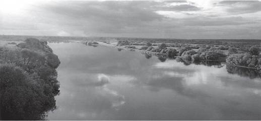
Ukraine’s physical geography is not complex, and most of its territory consists of lowland plains and plateaus that at their highest rise to about 1,600 feet (500 meters) above sea level. These include the Northern Lowlands and Coastal Lowlands, generally referred to as the steppe; that is, a plain which in its natural state is covered with a wide variety of lush grasses and shrubs. The lowland steppe is only interrupted in the west by the Volhynian-Podolian Plateau and in the far east by the Donets’ Ridge. Higher elevations are found only along the far edges of Ukraine: the Carpathian Mountains in the west, and the Crimean Mountains along the southern tip of the Crimean peninsula as it juts out into the Black Sea. The highest Carpathian peak is Hoverla (6,760 feet or 2,061 meters), the highest Crimean peak is Roman Kosh (5,061 feet or 1,543 meters). Mountainous regions account for only 5 percent of Ukraine’s landscape. Therefore, with the exception of the Carpathians, Ukraine lacks any natural barriers, and this has historically facilitated the movement of peoples—both friendly and unfriendly—whose aim may have been to settle, to conquer, or simply to pass through the country.
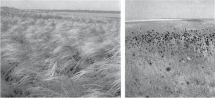
1.1 The grassland and shrub-covered steppe of southern Ukraine.
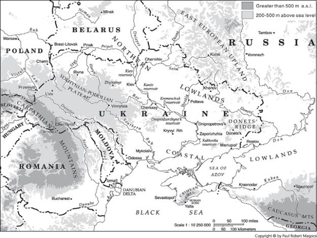
MAP 1 GEOGRAPHIC FEATURES
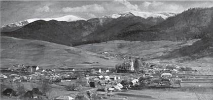
1.2 Carpathian Mountain peaks beyond the town of Volovets’ in the Transcarpathian oblast.
Communication has traditionally been facilitated by a network of rivers throughout plains and plateaus. Most run in a roughly north-south direction and are part of the Black Sea or Pontic Watershed. The center of Ukraine is dominated by the Dnieper (Ukrainian: Dnipro) River, historically a major communication route on whose banks is located the country’s capital city, Kiev (Ukrainian: Kyïv). Traditionally the course of the Dnieper River has functioned as the dividing line between two of Ukraine’s most important territorial, administrative, and geographic regions: the Left Bank to the east of the river, and the Right Bank to the west. During the twentieth century, the Dnieper was transformed into a major source of hydroelectric power, thanks to the construction of several dams which created at least five large-scale reservoir lakes: Kiev, Kaniv, Kremenchuk, Dniprodzerzhyns’k, and Kakhovka.
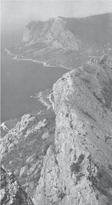
1.3 The Crimean Mountains along the shore of the Black Sea.
1.4 The broad Dnieper River which demarcates Left Bank (eastern) and Right Bank (western) Ukraine.
Aside from the Dnieper River and its tributaries (Pripet, Desna, Ros’, and Vorskla), other important rivers also running in a north-southeasterly or north-southwesterly direction into the Black Sea or the Sea of Azov are: the Dniester (Ukrainian: Dnister), the Southern Buh (Bug; Pivdennyi Buh), and the Donets’, which flows into the Don River just east of Ukraine’s boundary before emptying into the Sea of Azov. In the far southwest, Ukrainian territory borders on the northern arm of the Danube Delta providing a port (at Izmaïl) and therefore direct access to central Europe’s longest waterway, the Danube River.
It is only in the far western part of the country that Ukraine’s rivers are part of another European watershed, that of the Baltic Sea.
Both the Western Buh (Zakhidnyi Buh) River and the San River just beyond Ukraine’s border with Poland flow into the Vistula, which in turn enters the Baltic Sea. Strategically located between the Baltic and Black Sea watersheds is the city of L’viv, which even boasts having a building whose rooftop after a rainfall sees water flow on one side toward the north (the Baltic) and on the other toward the south (the Black Sea). Part of L’viv’s economic importance in the past was clearly a function of its access via river networks to both north-central and southeastern Europe.Ukraine’s climate, like its landscape, has few extremes. The annual average temperature for most of Ukraine is between +43° F and +48° F (+6° and + 9° C), with a January mean of + 23° F (5° C) and a July mean of + 68° F (+20° C). The average annual growing season is 205 days. The relatively moderate continental temperatures, adequate rainfall (with the exception of the Crimea), and the fact that two-thirds of the land surface consists of extremely rich soil (the so-called black earth or chernozem) are all factors that have contributed to making Ukraine one of the world’s most fertile agricultural regions.
Ukraine has long been known as the “breadbasket” of those states which have governed the country, whether the Polish-Lithuanian Commonwealth, the Russian Empire, or the Soviet Union. Since at least the nineteenth century the country has produced an abundance of grains (wheat, corn, rye, and barley) and industrial crops (hemp, sunflower, and sugar beets). Ukraine also has extensive mineral resources, especially coal, iron ore, and manganese. They are mostly found in the south-central and eastern parts of the country; that is, within the triangle formed by the cities of Kryvyi Rih-Dnipropetrovs’k-Zaporizhzhia, and in the Donbas encompassing the Donets’ Ridge and lower Donets’ valley. These two regions (see Map 36) have since the early twentieth century been among the world’s major industrial centers.
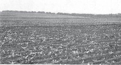
1.5 The black earth (chornozem) that covers much of steppe Ukraine.
MAP 2 UKRAINIAN ETHNOLINGUISTIC TERRITORY
alt=Images>