The Portuguese established the oldest and longest-lasting overseas European emŁpire, from the conquest of Ceuta in 1415 to the return of Macau to Chinese soverŁeignty in 1999.
Over five centuries, they created colonies in Africa, Asia, and South America; those territories became (or were integrated into) independent countries in 1822 (Brazil), 1961 (Goa and the other colonies in India), 1974-1975 (Guinea- Bissau, Mozambique, Angola, Sao Tome e Principe, and East-TimorŚalthough in the latter case followed by Indonesian occupation up to 1999), and 1999 (Macau).
This chapter will be structured around five questions: How can we understand this longevity? In what ways did local cultures shape specific configurations of the empire? What was the impact of the Portuguese Empire on other continents and on Europe? How was the Portuguese Empire's model adapted or refused by other European empires? Finally, how can we explain the empire's decline and disruption?
My argument is that the Portuguese Empire showed a variable geometry through time. The Portuguese established different relations with local populations, coped with challenges from regional and European powers, and compensated for losses in certain regions with increased investment in others. Slave trade and slavery played a crucial role in the Atlantic, but less so in the Indian Ocean. A conventional instituŁtional narrative provides a recognizable European framework, but fails to acknowlŁedge local agency in a fragmented empire with different ethnic configurations across continents. That is why this chapter addresses specific features and chronologies of the Portuguese Empire within an analytical framework.
Local government (municipalities) and confraternities (mainly the powerful misericordias sponsored by the king) were the two pillars of the empire.1 In the fifŁteenth century, the king leased the Atlantic islands (Madeira, Azores, and Cape Verde) to captains-donataries, although he later established customs houses and limited the delegation of judicial power.
General government was a feature of emŁpire from the beginning in Portuguese Asia, which spanned territories from East Africa to Macau. It was called Estado da India from 1505. General government was also introduced in Brazil in 1549, although there were already several captaincies- donataries in place, as seigniorial territories under royal lease, which remained until the mid-eighteenth century. Northwest African forts, created or occupied between 1415 and 1514, were abandoned between 1541 and 1550, with the exception of1 Boxer 1965.
Francisco Bethencourt, The Portuguese Empire (1415-1822) In: The Oxford World History of Empire. Edited by: Peter Fibiger Bang, C.A. Bayly, Walter Scheidel, Oxford University Press (2021). ® Oxford University Press. DOI: 10.1093/oso/9780197532768.003.0030.
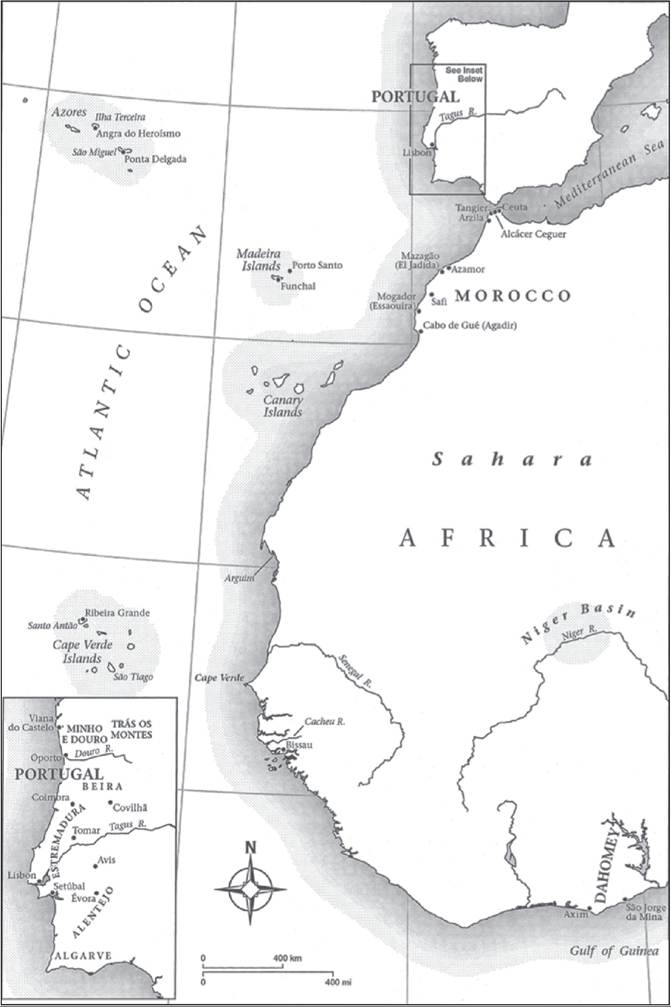
Map 30.1. Portuguese Settlements on the West Coast of Africa and on the Atlantic Islands.
Source: Bethencourt, 2007, Portuguese Oceanic Expansion, 1400-1800.
Copyright: Cambridge University Press.
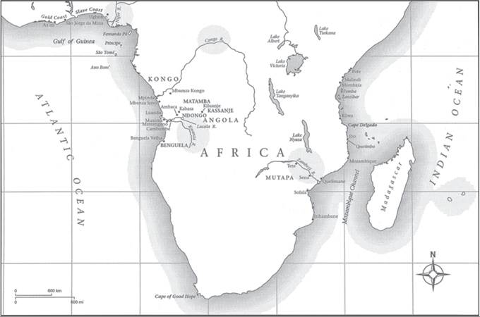
Map 30.2. Portuguese Settlements and Main Points of Trade in Central and East Africa.
Source: Bethencourt, 2007, Portuguese Oceanic Expansion, 1400-1800. Copyright: Cambridge University Press.
Ceuta, Tangier, and Mazagao. They were generally controlled by captains from the same set of noble families, although without a seigniorial delegation of royal powers.
The chronology of the Portuguese Empire can be defined by the different geoŁgraphical axes that succeeded one another over time (see Maps 30.1-30.4). In the fifteenth century, the empire was organized in the North Atlantic, based on forts in Northwest Africa, trading posts in West Africa, settlements in Madeira, Azores, Cape Verde, and Sao Tome. In the sixteenth century, the axis of the empire shifted to the Indian Ocean after the voyage of Vasco da Gama (1497-1499) and the conquest of Goa, Malacca, and Hormuz (1510-1515), followed by the occupation (or lease) of territories, enclaves, and ports in Mozambique, Persian Gulf, India, Southeast Asia, Sri Lanka, China, and Japan.
In the late sixteenth century, the empire started to shift to the South Atlantic, due to extensive migration to Brazil and the expansion of the plantation system, which was fueled by slave trade from the western coast of Africa. In the mid-seventeenth century, the intercontinental war against the Dutch, who were victorious in the Indian Ocean and defeated in the Atlantic, confirmed this final shift of the axis of the Portuguese Empire, a fact that was reinforced by the discovery of gold and precious stones in Brazil at the end of the seventeenth cenŁtury. In 1822, the independence of Brazil delivered a major blow to the Portuguese Empire. The empire resisted collapse in different parts of the world, although the investment in Africa took a long time to yield results. Prosperity in Angola and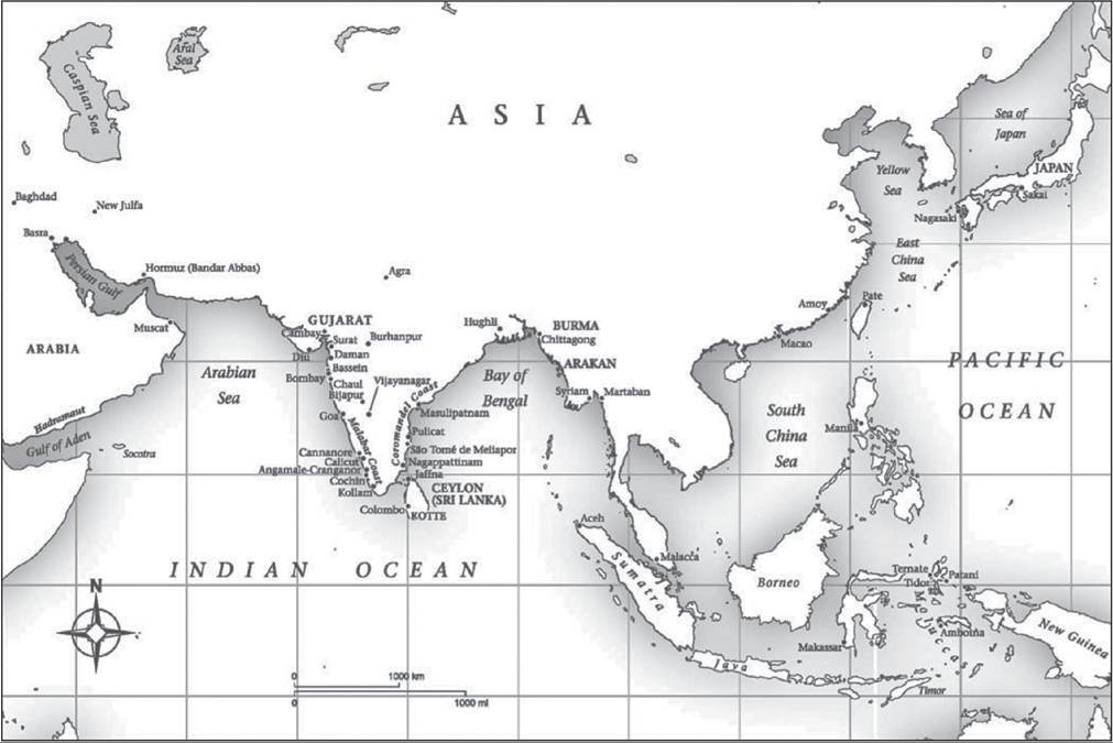
Map 30.3. Portuguese Settlements and Main Points of Trade in Asia.
Source: Bethencourt, 2007, Portuguese Oceanic Expansion, 1400-1800. Copyright: Cambridge University Press.
THE PORTUGUESE EMPIRE (1415-1822) 835
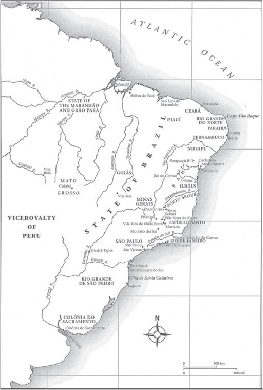
Map 30.4. Portuguese Settlements in Brazil.
Source: Bethencourt, 2007, Portuguese Oceanic Expansion, 1400-1800. Copyright: Cambridge University Press.
Mozambique ironically only peaked in the 1960s, during the liberation wars, which triggered both the democratization of Portugal and general independence of the colonies.
1.