Note on Transliteration and Dating
The transliteration of the names of people and places is a nightmare in a book that covers such a long period and embraces so many cultures, as well as changes of regime. I have tried to combine authenticity with clarity.
With Greek names, I have preferred forms closer to the original Greek sounds than the Latinized forms long in use: Periplous for a book in Greek describing maritime routes, rather than the bastardized form Periplus ; Herodotos not Herodotus. Old Norse names have been kept as close as possible to what is in the sources (omitting the final -r of the nominative form); and, now that Icelandic crime stories are widely read, I am confident people can cope with D and 3 (soft ‘th’ as in ‘that’) and h and (hard ‘th’ as in ‘thin’), valuable letters which are a sad loss from the English alphabet. Turkish i is a short vowel similar to the ‘i’ in ‘sir’, c is ‘j’ and g is ‘ch’. I have rendered Polynesian glottal stops with a ’, though I am aware that many transcriptions use ‘, which I have used for Arabic names to represent the guttural sound known as ‘ayin.Place names are particularly difficult; some have been officially changed only in recent times, even if they have more ancient origins (Essaouira for Mogador ; Mumbai for Bombay ; Sri Lanka for Ceylon; Gdansk for Danzig ), and I have sometimes switched back and forth. Where European and indigenous names are very similar I have preferred the indigenous version, if it is in current use: Melaka rather than Malacca, recognizing that the city originated a hundred years before the Portuguese conquest (but one still talks of the ‘Malacca Strait’); Macau rather than Macao. I have alternated between New Zealand and the lovely Maori name Aotearoa (‘Long White Cloud’). Guangzhou became known to westerners as Canton, a Portuguese corruption of Guangdong (the name of the wider region); but it would be perverse to call ancient Guangzhou ‘Canton’, so I have used ‘Canton’ only when writing about the period of intensive European trade up the Pearl River.
Generally, I have done my best to use modern pinyin spelling of Chinese names, so Zheng He instead of Cheng Ho for the famous admiral, and Quanzhou rather than the older transliteration of ChUan-chou, even though the ‘q’ sound in pinyin is closer toxxxii NOTE ON TRANSLITERATION AND DATING
‘ch’ or ‘ts’ than to ‘k’. The Korean pirate Chang Pogo is, however, generally known by the old version of his name, which I have preferred.
Nowadays it is quite common to find bce and ce being used instead of bc and ad, even though the actual date remains exactly the same. Since, for those who do not want to use a Christian dating system, bc could stand for ‘Backward Chronology’ just as well as ‘Before Christ’, and ad could stand for ‘Accepted Date’ instead of Anno Domini, I have retained the traditional forms. bp, on the other hand, signifies ‘Before the Present’, and is used by archaeologists among others, generally calculating backwards from 1950, so not quite the ‘present’.
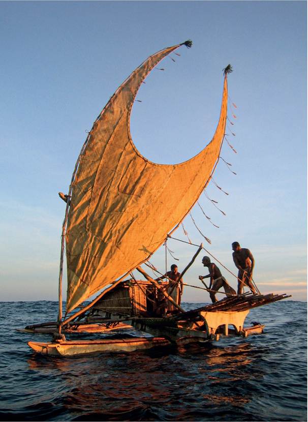
i. Polynesian boats used several shapes of sail. This boat is equipped with a claw sail, and an outrigger is attached, adding greatly to its stability. Such boats have sailed the Pacific for millennia.
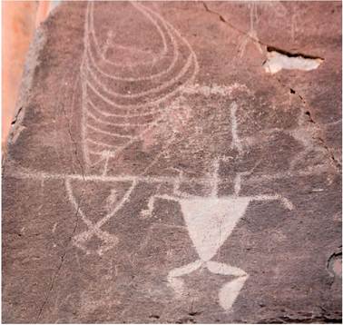
2. By the ninth century ad Polynesian navigators had settled the Hawai’ian archipelago. This early image of a boat with a claw sail, carved on a rock in Maui, may date back to the early settlements.
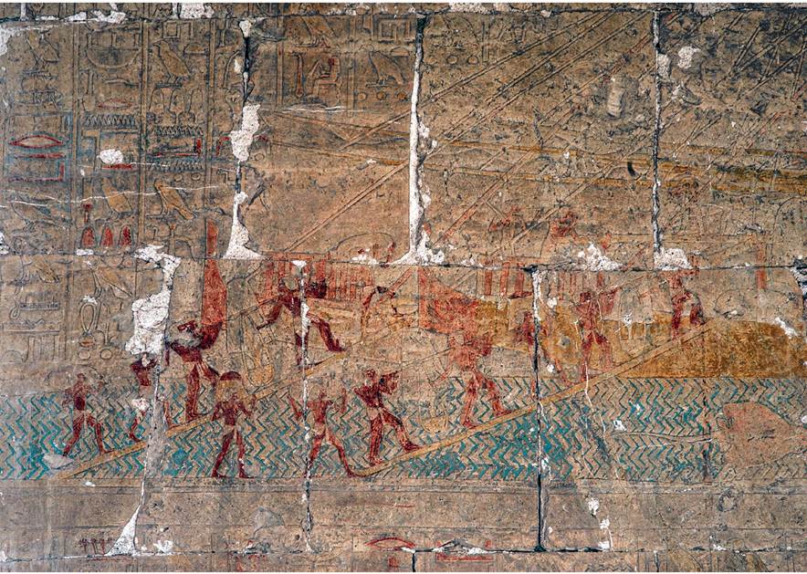
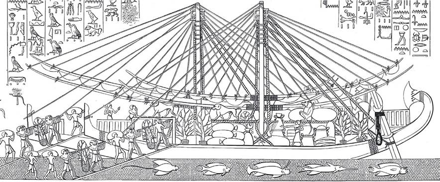
3-4. Around 1450 bc the female pharaoh Hatshepsut sent a fleet down the Red Sea to collect myrrh, ivory, ebony and exotic animals from the ‘Land of Punt’. Her expedition was commemorated in her funerary temple near Luxor, which contains inscriptions describing her fleet as the first to have been sent out since ‘the olden days’.
The detail, showing men loading two ships with sacks of goods and entire frankincense trees, is clearer in the line drawing below.At_ d '®h i i?»X
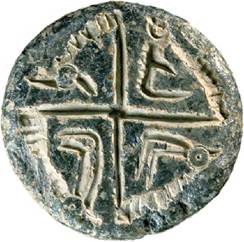
5. Four gazelles on a seal of the late third millennium bc from the trading centre of Dilmun (Bahrain).
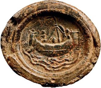
6. An Indian seal of the fourth or
fifth century ad showing a sewn- plank ship. Similar ships were probably sailing the Indian Ocean two millennia earlier.
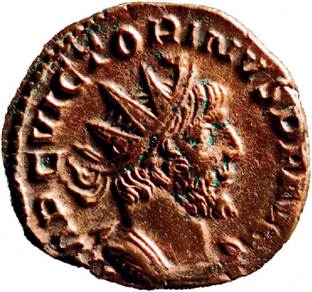
7. A coin of the Roman emperor Victorinus minted in Cologne c.ad 270, found in Thailand.
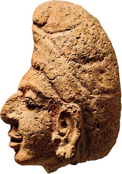
8. Head of a Persian or Arab merchant, seventh or eighth century ad, from Thailand.
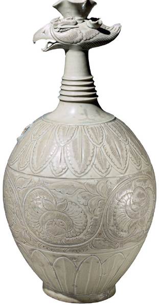
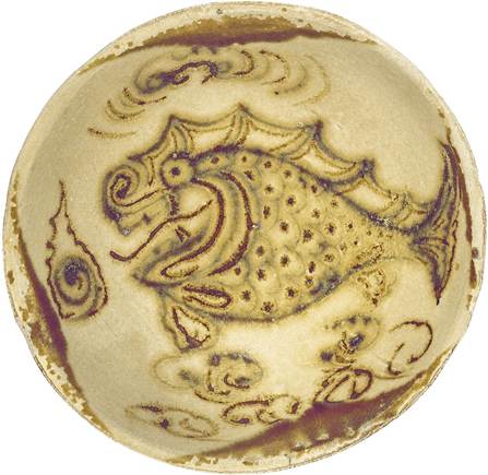
9. White porcelain ewer, decorated with the image of a phoenix, that reached Cairo from China c.ad 1000.
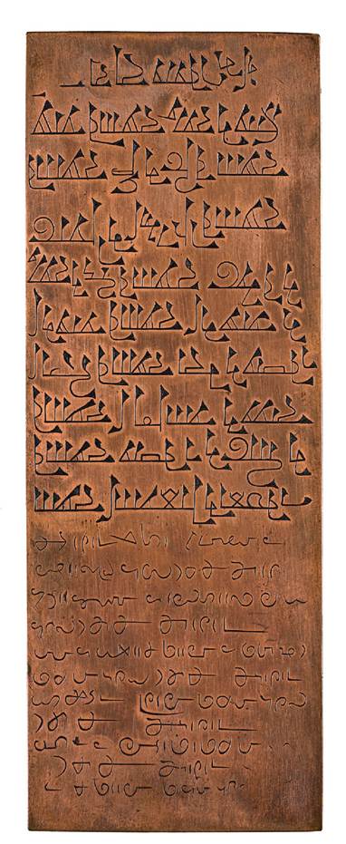
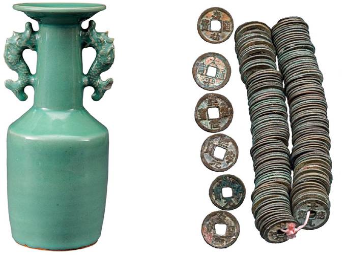
11. Multilingual copper plates from Kollam, in south India, of ad 849 testify to the presence of Zoroastrian, Jewish and Muslim merchants.
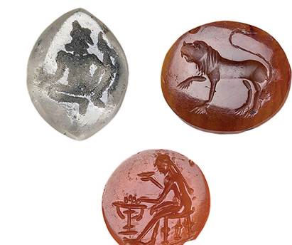
10. Sixth-century intaglios from Oc-èo in southern Vietnam, the meeting point of traders from China and Persia.
■ W1'
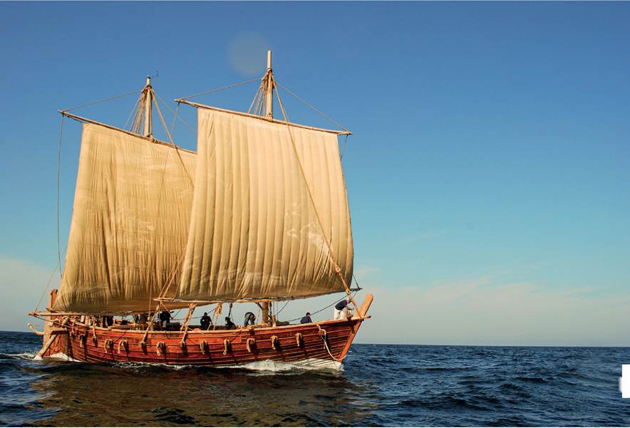
12. Reconstruction of a typical Arab sewn-plank ship based on the ninth-century Belitung wreck from Indonesia. The ship may have been travelling from the Chinese imperial court to an Indonesian ruler carrying gifts in return for tribute.
13. The Belitung wreck contained 70,000 pots, the largest collection of late Tang pottery ever found, including many pieces from Changsha in central China. It probably carried silk as well, but that has disintegrated.
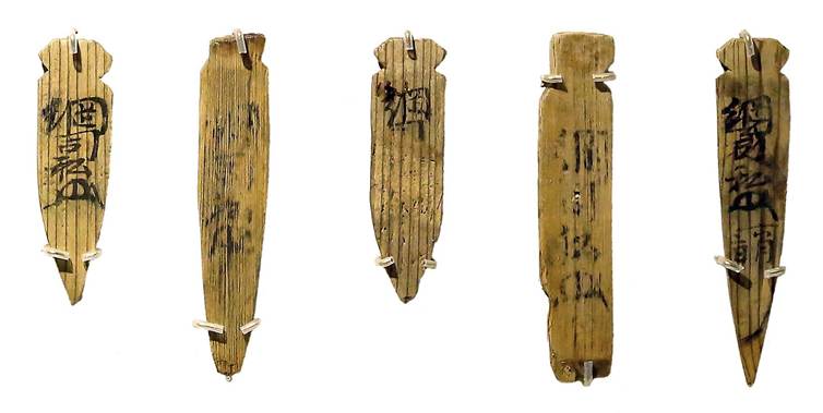
14. In 1323 a Chinese junk was wrecked off the coast of Korea, carrying more than 8,000,000 coins to Japan. Tags such as these were attached to bundles of coins, indicating that the voyage was carried out on behalf of the Tofuku-ji monastery in Kyoto.
15. The same wreck contained a large cargo of top-quality celadon decorated with animal motifs.
16. Medieval Chinese currency consisted of low-value copper coins strung together. Drainage of bullion out of China led the Song and Yuan emperors to create a paper currency.
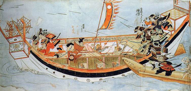
17· An early fourteenth-century scroll commemorating the heroism of the warrior Takezaki Suenaga in the wars against the Mongols. Here a Mongol ship is under attack from Japanese warriors in 1281·
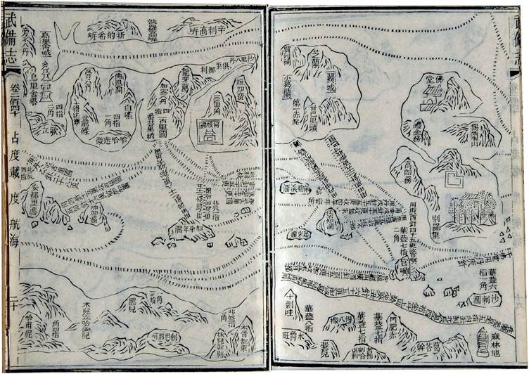
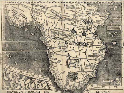
18. A seventeenth-century printed map of the voyages of Admiral Zheng He at the start of the fifteenth century. His ships reached east Africa and the Red Sea.
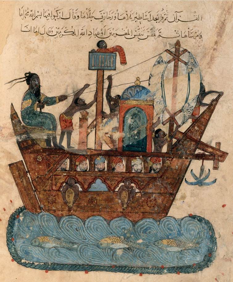
19. A late medieval image of a sewn-plank ship bound from Basra in Iraq. Black slaves bail out water and work on deck, while Arab, Persian and Indian passengers sit below.
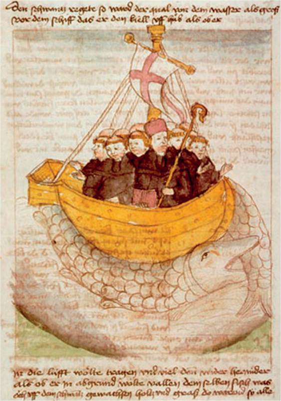
20. Irish legend told of the intrepid navigator St Brendan, who sailed into the Atlantic with his monks looking for remote islands where they could live far from ordinary human company.
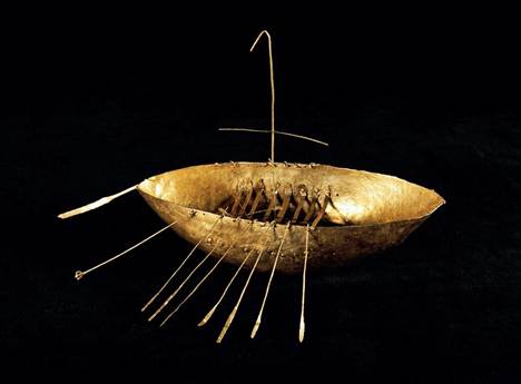
21. A golden model of a boat, twenty centimetres long, from Broighter in Northern Ireland dating from the first century bc or ad. Early Irish ships were made of wicker frames covered in skins.
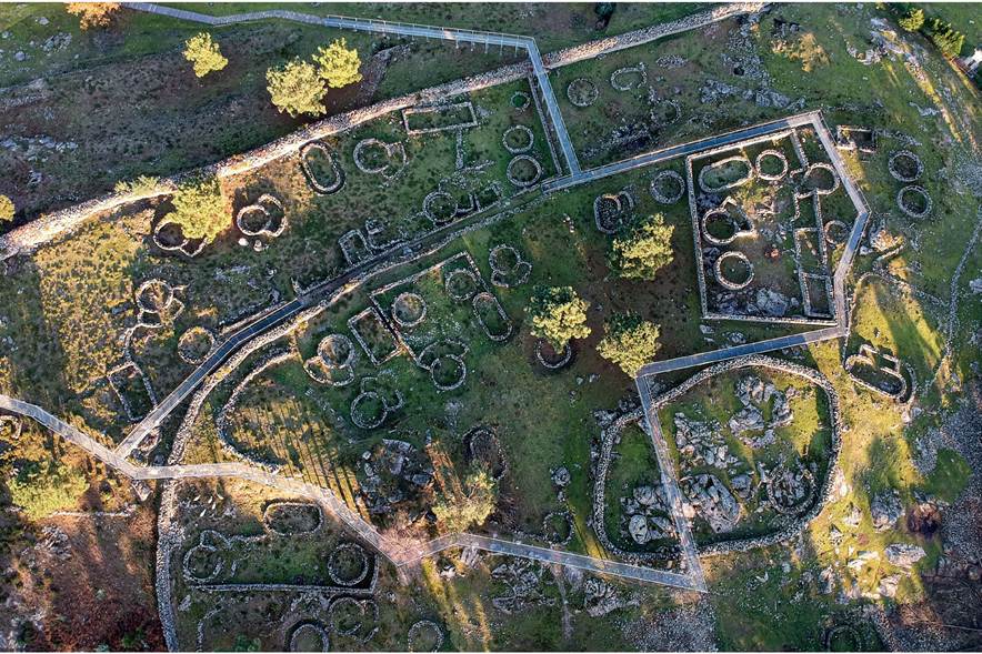
22. Overlooking the Atlantic, this Iron Age settlement at Viana do Castelo in northern Portugal contained dozens of roundhouses and was ringed by walls with watchtowers.
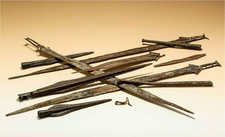
23. A bronze hoard from the Bay of Huelva in south-western Spain contained several ‘Carp's Tongue' swords fashionable along the Atlantic coasts around 800 bc.
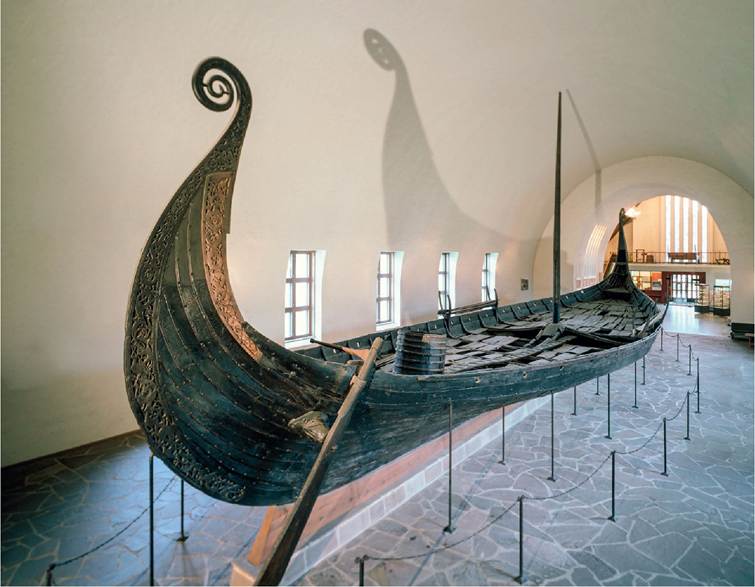
24. The Oseberg ship from Norway, of c.ad 820, was superbly carved out of oak. It was used for the burial of a queen or high priestess and carried an array of grave goods.
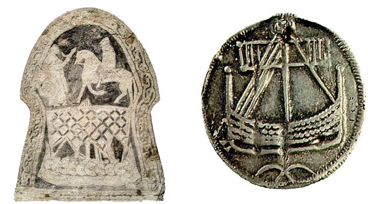
25. Viking sails were made of plaited strips of cloth, producing a lozenge effect. Viking picture stones often portray the journey to the next world aboard a ship.
26. A coin from Haithabu in southern Denmark found in Birka in central Sweden provides evidence for trade between these early Viking towns.
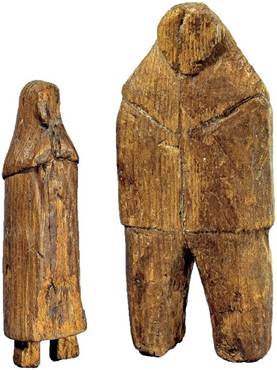
27. Inuit carvings from Greenland, thought to show the Norse inhabitants with whom they made contact.
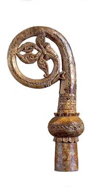
28. The crozier of Bishop Olafur of Gardar (d. 1280), brought to Greenland from Scandinavia.
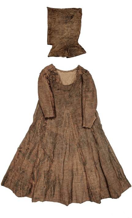
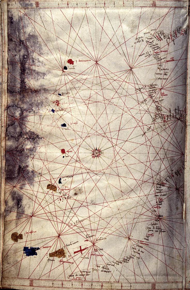
29. Fifteenth-century clothing from Greenland, reflecting current European fashions.
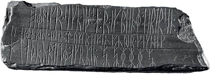
30.
In the thirteenth century or later two Norse Greenlanders sailed as far north as 72°55'N. and left this record of their visit in runes.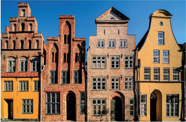
3i. Wealthy Lübeck merchants built fine houses along the waterfront, containing offices, storerooms and accommodation.
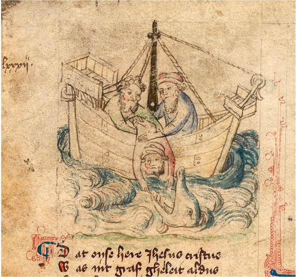
32. Jonah and the Whale from an early fifteenth-century Dutch manuscript. The ship closely resembles the Hanseatic cogs of this period.
■-'■.A. »·
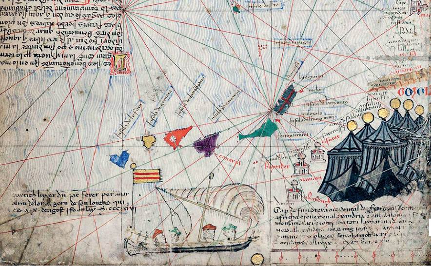
33· The Catalan World Atlas of 1375 commemorated the voyage in 1346, in search of gold, of Jaume Ferrer of Majorca, past the Canaries, which are shown, and down the coast of Africa, from which he never returned·
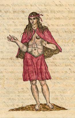
34· A late sixteenth-century image of a noblewoman from La Gomera in the Canaries· The pagan islanders, mostly naked and ignorant of metal, were a surprise to explorers·
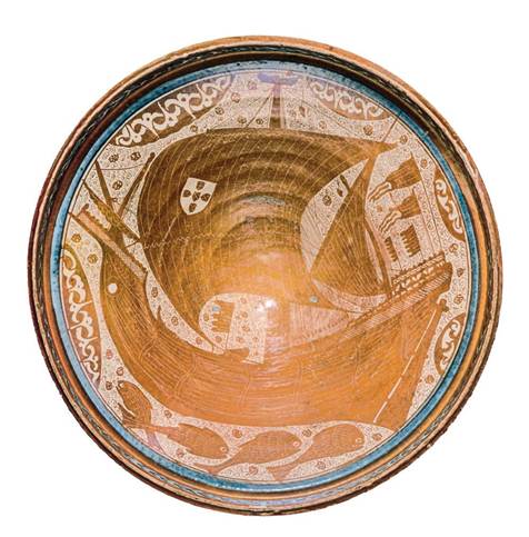
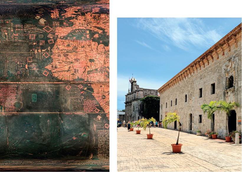
35· A magnificent glazed bowl from fifteenth-century Malaga, in the Muslim kingdom of Granada, showing a Portuguese caravel under sail·
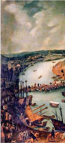
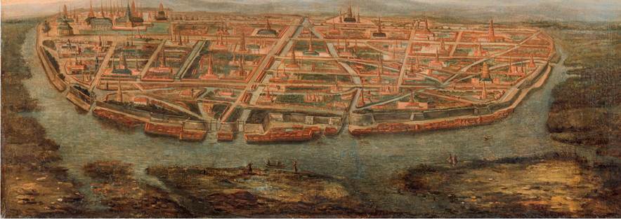
36. A Venetian atlas of the early fifteenth century shows a scattering of Atlantic islands, including Madeira (south-west of the central compass), the Canaries and several imaginary ones.
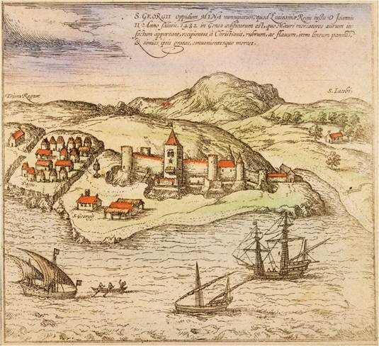
37· The Portuguese fort at Elmina in Ghana was a centre of trade in gold and slaves, founded in 1482 and built out of stones brought from Portugal·
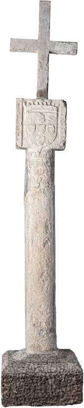
39. Portuguese padroes also appear on Martin Waldseemuller’s massive world map of 1507, along the coasts of southern Africa.
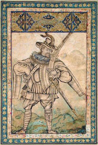
38· In 1894, following the German colonization of Namibia, this padrao marking the arrival of the Portuguese at Cape Cross in i486 was carried off to Berlin. In May 2019 Germany agreed to return it to Namibia·
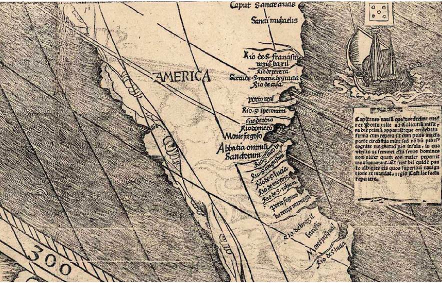
40. Martin Waldseemuller celebrated Amerigo Vespucci’s voyages by labelling part of the New World ‘AMERICA’.
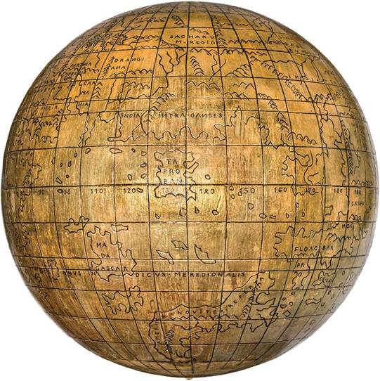
41. A globe of c.1510 in the Jagiellonian University, Krakow, mistakenly labels an imaginary continent south of Ceylon ‘Newly Discovered America’.
42. Martin Behaim’s globe of 1492 assumes that Japan, China and the Spice Islands can be reached by sailing westwards from Europe, a view shared by Columbus.
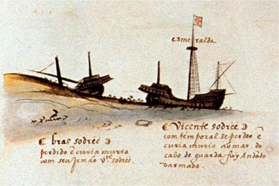
43. In 1503, on da Gama’s second Indian voyage, the Esmeralda was torn from its moorings during a violent storm and foundered off the coast of Oman. The wreck was discovered in 1998.
44. The Spanish seat of government in early sixteenth-century Santo Domingo forms part of the oldest, largest and best-preserved colonial quarter in the Americas.
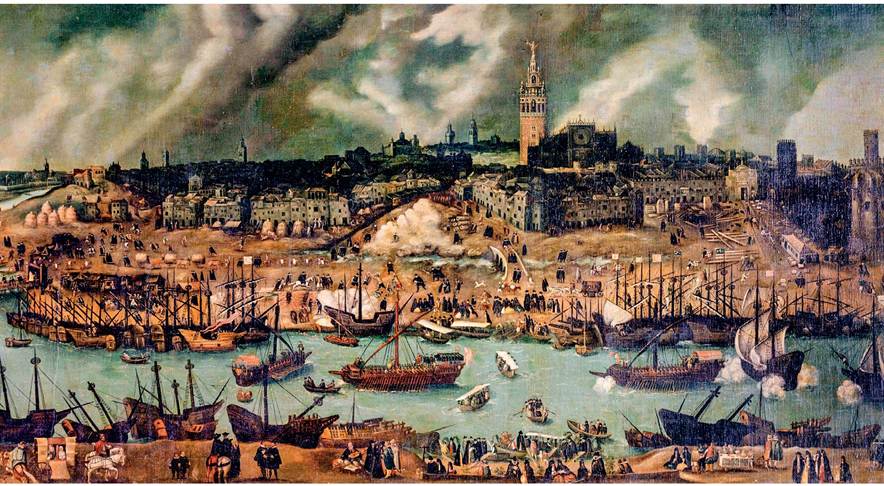
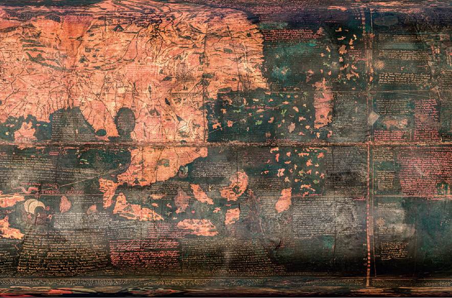
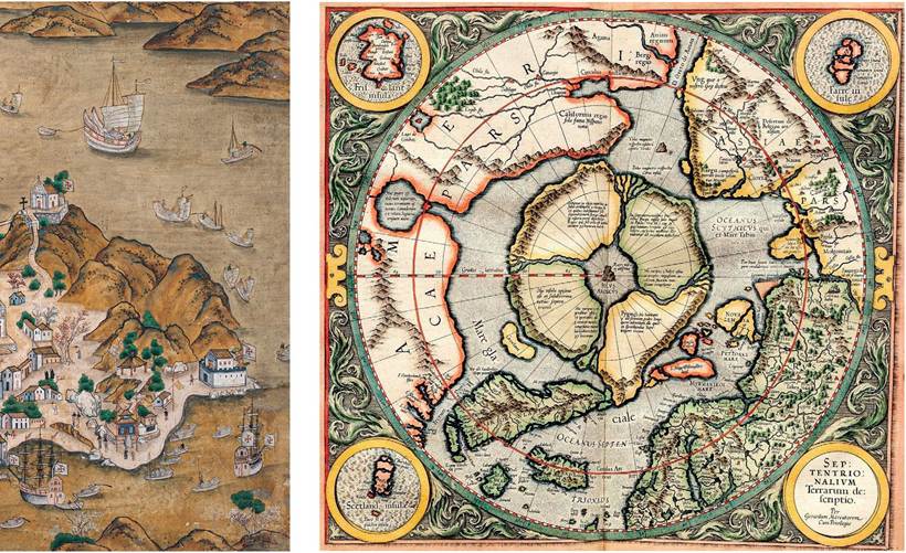
45. Seville c.1600. Atlantic shipping worked its way up the Guadalquivir River to the wharves of Seville. The Moorish Giralda Tower looms over the city.
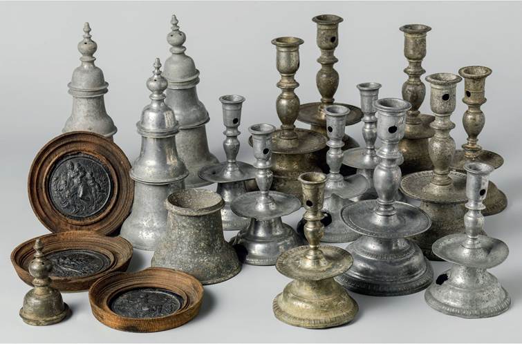
46. An early seventeenth-century Indian portrait of the ruthless Portuguese commander Afonso de Albuquerque (d. 1515).
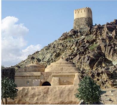
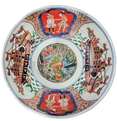
47. Portuguese watchtower at Badiya on the Gulf of Oman, overlooking a fifteenth· century mosque.
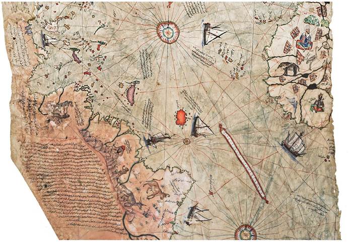
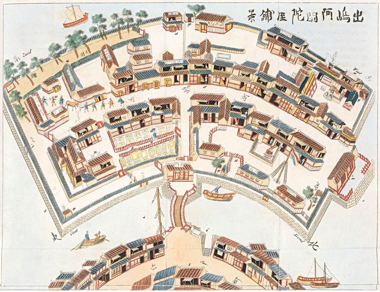
48. The first map by the Turkish corsair Piri Reis, of 1513, reveals detailed knowledge of Iberian voyages to the New World, partly acquired from a Spanish captive.
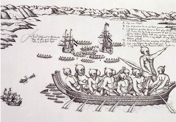
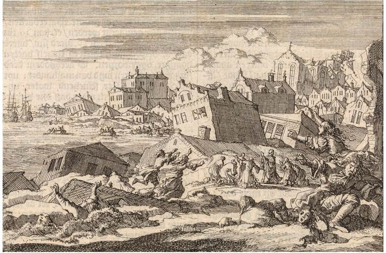
49. In 1642 Abel Tasman's fleet reached the South Island of New Zealand and was met by hostile Maoris who killed four Dutch sailors.
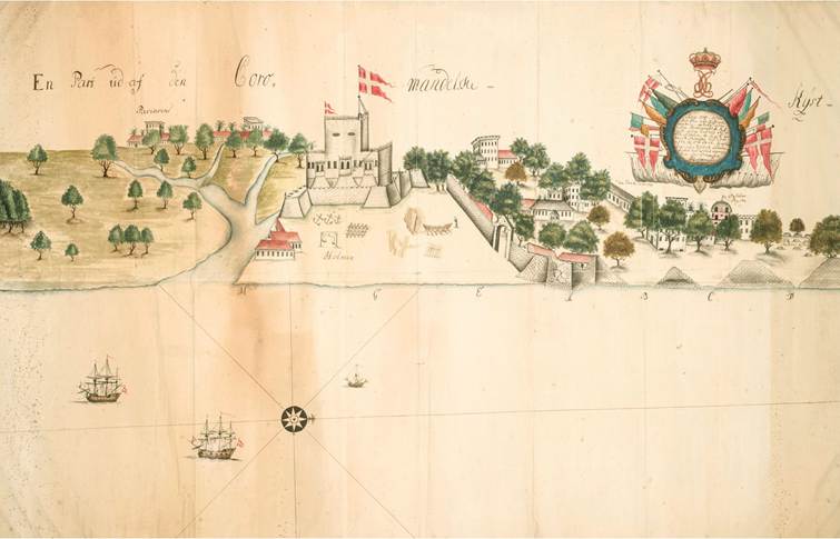
50. Founded in 1350, Ayutthaya in Thailand was an important trading centre linking the Indian Ocean to the South China Sea, from which the Dutch acquired enormous quantities of elephant ivory and rhinoceros horn.
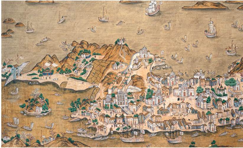
5i. Map of Macau showing the imposing facade of St Paul's Church a little to the left, with the fort and Jesuit College behind it. The main port, at the bottom, lay on the western side.
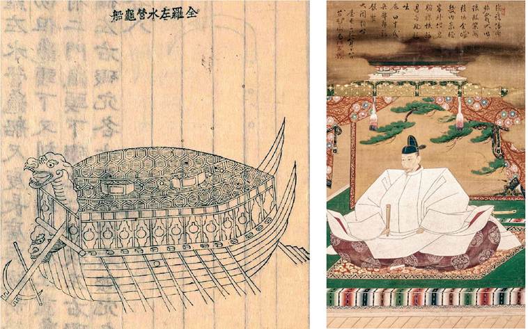
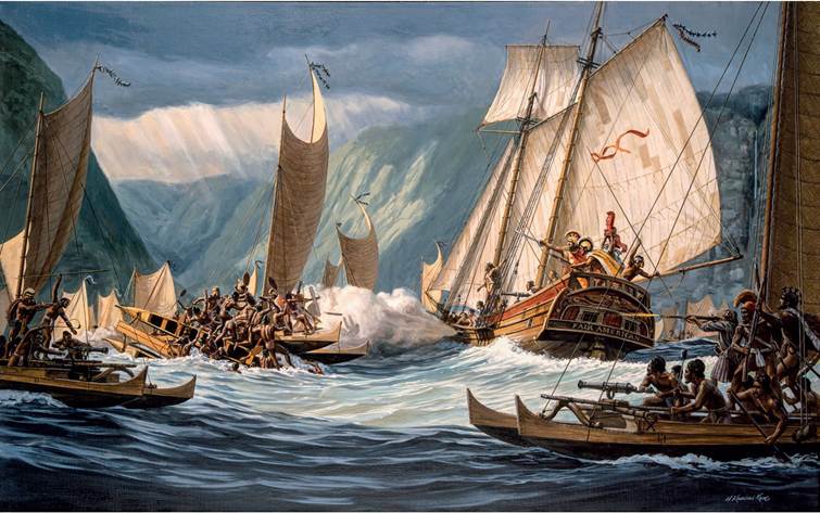
52. In 1597-8 the great Korean admiral Yi Sun-sin successfully deployed ‘turtle ships' against a much larger Japanese navy.
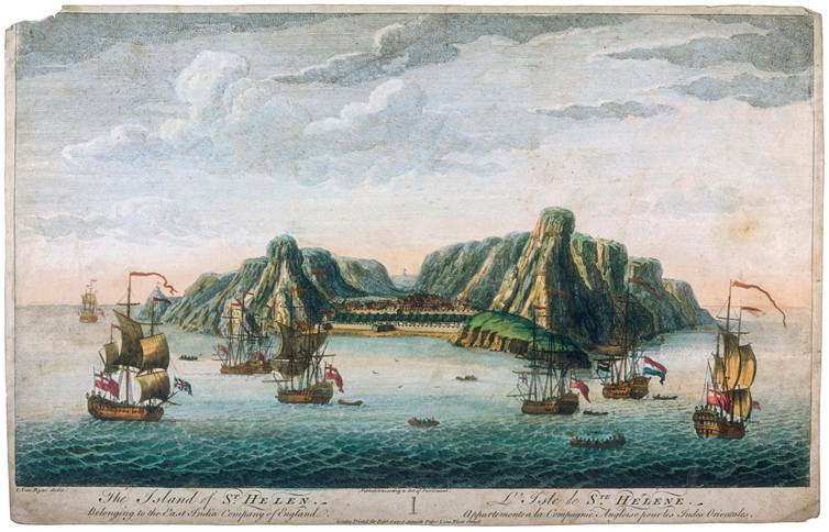
53. The regent Toyotomi Hideyoshi blew hot and cold towards Jesuit missionaries and Japanese Christians.
54· Mercator’s world map imagined that the North Pole was surrounded by four large islands, and that a route to China through the Arctic Ocean was impossible. This version dates from 1595·
55. In 1596-7 Willem Barentsz and his crew endured a freezing winter in the Arctic, leaving behind pewter candlesticks and merchandise rediscovered by a Norwegian skipper in 1871.
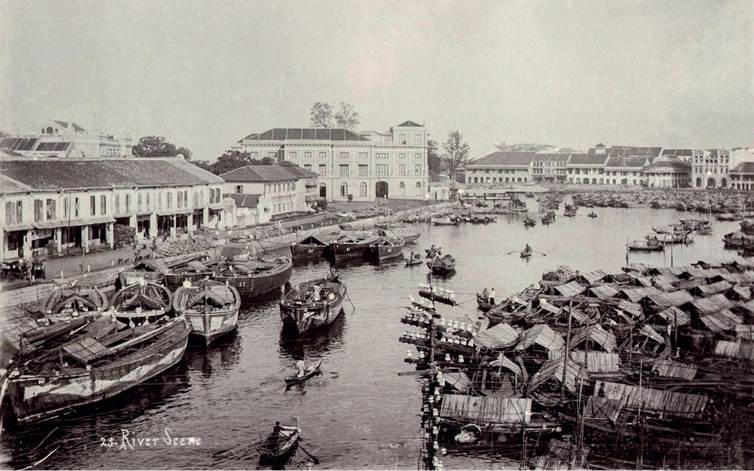
56. A Japanese bowl of c.1800 portrays Dutch ships and merchants, at that time the only foreign traders permitted to visit Japan. They are still shown as they would have dressed 150 years earlier.
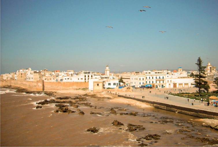
57. The Dutch settlement at Deshima, off Nagasaki, resembled a miniature Dutch town, with a flower garden but no church, as that was banned by the Japanese.
58. At midday on 7 June 1692 a huge earthquake and tsunami demolished the capital of English Jamaica, Port Royal, resulting in 4,000 deaths.
59. In the early seventeenth century the Danish East India Company acquired Fort Tranquebar from a south Indian ruler. Much of its business consisted of ‘country trade' within the Indian Ocean and the South China Sea.
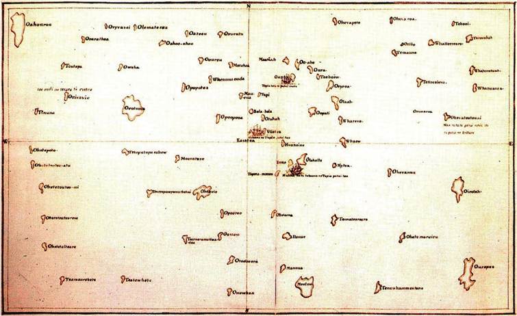
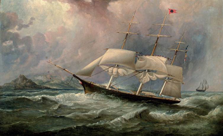
60. The Polynesian navigator Tupaia accompanied Captain Cook around the Pacific islands. His very detailed map was drawn from memory, but he had no knowledge of Hawai'i and New Zealand.
61. In 1791, King Kamehameha of Hawai'i, who had acquired a fleet of European- style ships, defeated his rivals at the Battle of the Red Mouthed Gun. Most Hawai'ians used traditional boats - note the similarity of the claw-shaped sails of Kamehameha's adversaries to that in Plate 1.
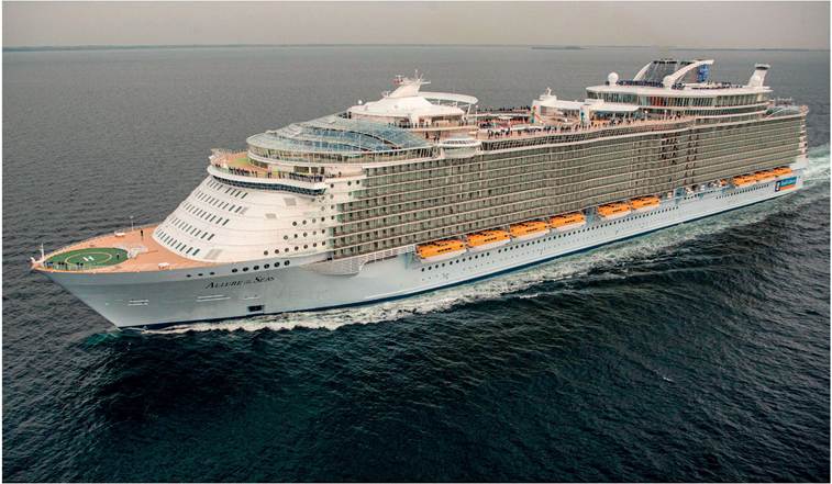
62. In 1658 Oliver Cromwell's son and momentary successor, Richard Cromwell, granted the English East India Company the right to settle St Helena, which became a resupply station for English operations across the oceans.
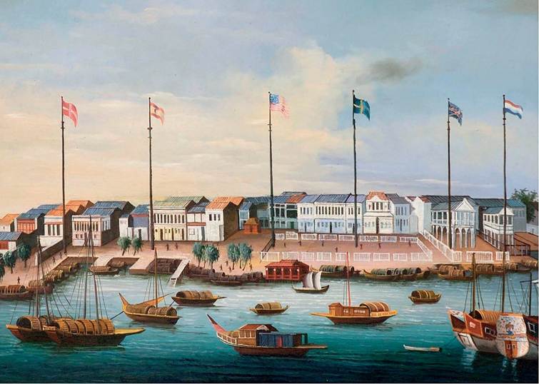
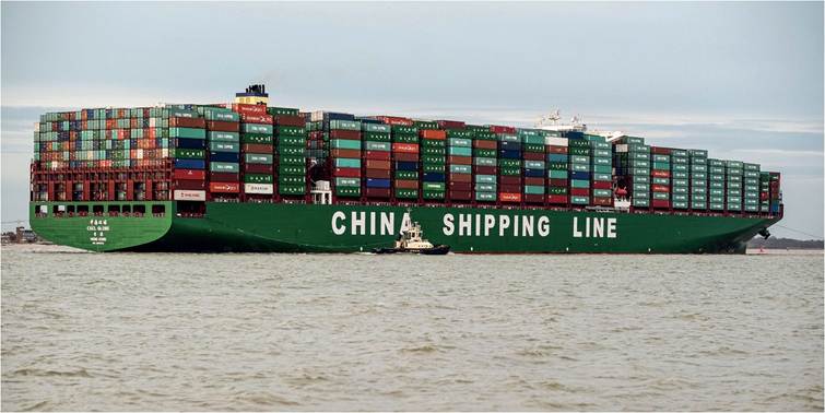
63. The warehouses of the European merchants trading in Canton proudly displayed their flags. In this image of c.1820 the flags of Britain, Sweden, the United States and other countries are visible.
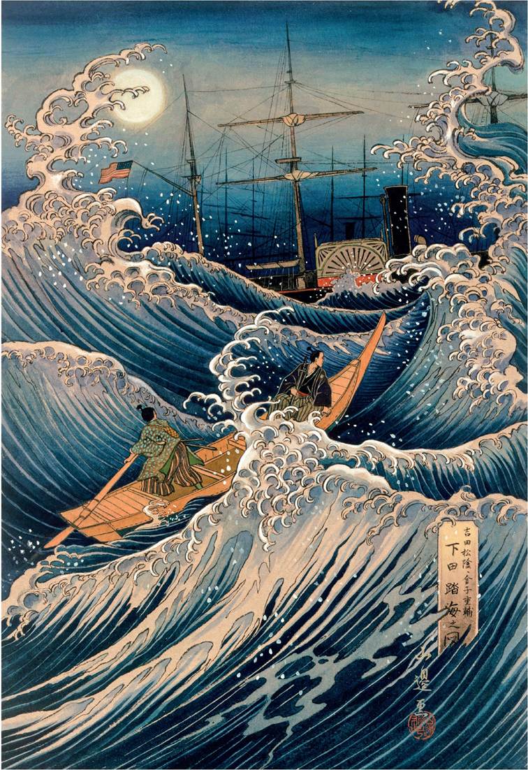
64. Even if Commander Perry's visit to Japan in 1853 only opened the door to foreign traders by a crack, the sight of his ironclad steam paddleboat fascinated the Japanese.
65. The estuary of the Singapore River was lined with ‘godowns’, storage facilities for the goods that passed through the port between the Indian Ocean and the South China Sea.
66. The white houses on the right were home to the Jewish merchants of Mogador (Essaouira), who controlled the tea trade from England to Morocco. From their windows in the royal casbah they looked out over the wharves where their goods were unloaded.
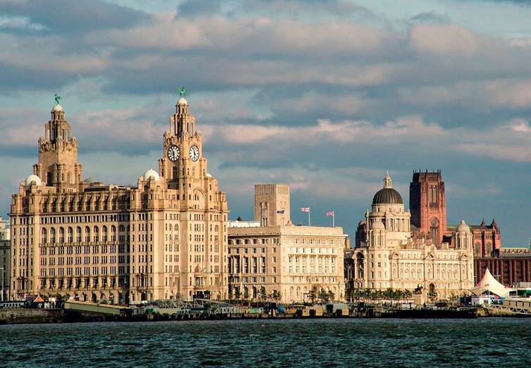
67· The massive buildings erected in the port of Liverpool at the start of the twentieth century included the Royal Liver Building and the Cunard offices. This was the city’s golden age·
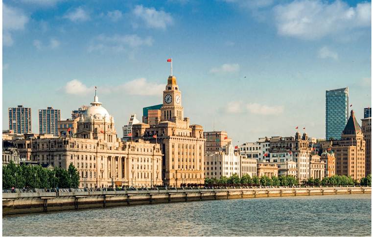
68. In a similar style to the Liverpool waterfront, the bustling street along the river in Shanghai, known as the Bund, hosted banks and trading companies and included the vast Sassoon headquarters, far right.
69. Even after the triumph of the steamship, tea, grain and mail clippers raced to their loading stations in China and Australia and back to Europe. Here is the Ocean Chief in the 1850s on the Australia run.
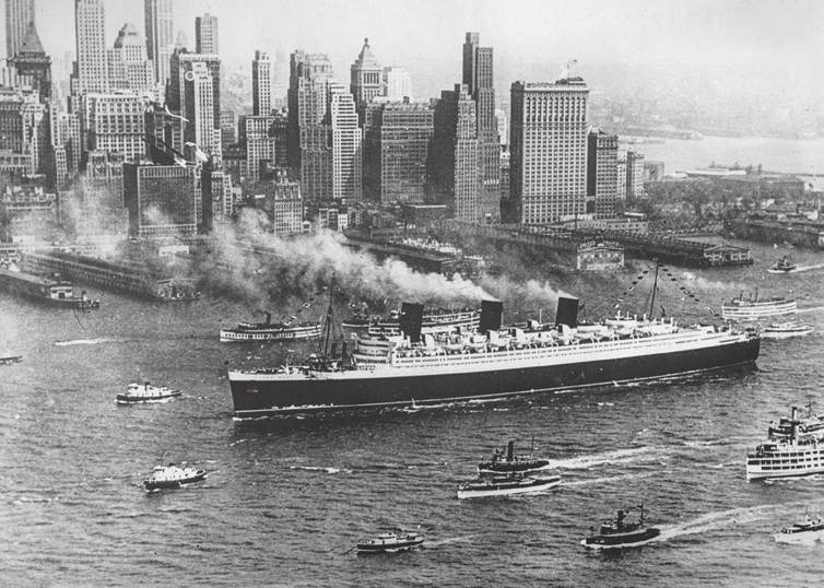
70. The pride of the Cunard White Star fleet, the Queen Mary, arriving in New York on
8 August 1938. The interwar years were the great age of international liner voyages.
71. The largest cruise ship in the world at the time this book was being written, the Allure of the Sea has capacity for more than 7,000 passengers.
72. The largest container ship in the world at the time this book was being written, the CSCL Globe has capacity for more than 19,000 containers.
More on the topic Note on Transliteration and Dating:
- System of Transliteration and Dating
- Contents
- Abulafia David. The Boundless Sea: A Human History of the Oceans. Oxford University Press,2019. — 1088 p., 2019
- Contents
- Abulafia David. The Great Sea: A Human History of the Mediterranean. London: Allen Lane; Penguin Books,2012. — 816 p., 2012
- AUTHOR’S NOTE
- History and Terminology
- NAMES AND DATES
- I Terminology and Guiding Principles
- Borderlands or Former Colony?